NDDN Committee Report
If you have any questions or comments regarding the accessibility of this publication, please contact us at accessible@parl.gc.ca.
Appendix A: Approximate Distances Between Selected Military Sites in Canada
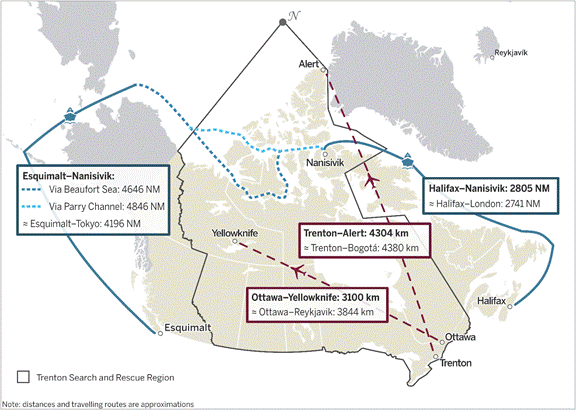
Source: Map prepared in 2023 using data from Natural Earth, 1:50m Cultural Vectors and 1:50m Physical Vectors, version 5.1.1; Department of National Defence, Canadian Armed Forces bases and support units and National Search And Rescue Manual, page 26; Naval routes and distances from Smart, Dave, AOPS & the Arctic: Future Trends and Influences, Presentation to the CFPS Arctic Workshop, Centre for the Study of Security and Development, 5 June 2015, page 29; Naval distances also from SEA-DISTANCES.ORG; Flight distances calculated by map author. The following software was used: Esri, ArcGIS Pro, version 3.0.2.