Start of content

NDDN Committee Report

If you have any questions or comments regarding the accessibility of this publication, please contact us at accessible@parl.gc.ca.

PDF

APPENDIX J: TERRORIST INCIDENTS IN MALI (2013-2017)


The main focus of the map is Mali, with an indication of the location of terrorist incidents that occurred between 2013 and 2017. The areas of conflict in the country are shown within the northern and central regions of Tombouctou, Kidal, Gao, Mopti and Segou. According to the map, while most of the terrorist incidents occurred in Mali’s north (Tombouctou, Kidal and Gao), the number of incidents in the central region (Mopti and Segou) increased over time. The map also shows the terrorist incidents that occurred in southern Mali over the 2013 to 2017 period.

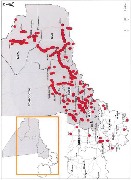
Source:  Global Affairs Canada, “Mali and Canada: An Enduring Partnership,” document distributed to the House of Commons Standing Committee on National Defence in Bamako, Mali, 12 February 2019.