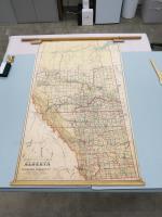
Alberta map
E.N. Moyer Company (in business from 1912-1980), known as Canada's School Furnishers, produced a series of maps designed for educational use. This map was most likely utilized as a teaching tool in Canadian schools, helping students visualize the geographic distribution of communities and infrastructures within Alberta.
This period (circa 1920) marked an era of expansion in the province, reflected in the details of this map. Additionally, the map delineates boundaries, land districts, land recording divisions, and electoral divisions, providing a comprehensive overview of the administrative landscape of Alberta during the early 20th century.
Historic maps such as these serve to not only demarcate the physical landscape, but also give us a glimpse into Canadian history, geography, and education practices at a specific moment in our shared past, by offering an intricate picture of the province's communities, infrastructures, and natural landscapes.